Route description
The Pound
At the junction of Waterside and Amersham Road is where the pound used to stand. Throughout the middle ages, any animals found straying were impounded here. To release them the owner had to pay the Lord of the Manor one penny for a small animal or two pence for a large one.
Proceed along Wateside, to the left of ‘The Pound’
Weedon’s Almshouses
They were erected in 1624 by Thomas Weedon, draper of London, whose father farmed in Pednor
No. 71–79 Waterside, Bagnall Centre
This large building used to be the Hayes Boot Factory. Subsequently, it was a printers, and then became The Bagnall Centre.
No. 98 Waterside
The site of the Foresters Arms which closed in 1933 to become a lodging house.
The Motor Depot
It was built for Thomas Wright’s woodwork business in the 19th century.
Waterside Business Park
Formerly Reynolds Yard, it was once the site of a steam saw mill. The trunks of trees were drawn up the steep slope, by cart horses and were cut up for the woodware industry.
Waterside Court
The site of the New Inn pub. For many years it was run by WWI hero, Alfred Burt VC.
Silverson
The area to the right just after the railway bridge was once watercress beds which closed in the 1960s.
Chiltern House
This was the toy factory of HG Stone who was famous for their ‘Hugmee’ bear.
Hospital Hill
The large housing block on the left was once the site of the Chesham Gas Works. Before the days of natural gas from the North Sea, each town made their gas from coal. This was brought by horse drawn cart from Berkhamsted until the Metropolitan Railway arrived in 1889. At the top of the road used to stand Chesham Cottage Hospital. It was built in 1869 but shortly after opening had to deal with a major outbreak of typhoid. The hospital was extended in 1923 as a memorial to those who died in WWI. It closed in 2005.
Gordon Road
This used to be the site of Shutes silk mill that drew water from artesian wells. The site was taken over by the Royal Bucks Laundry for about 100 years.
Straw plaiting
In the 1841 census there were 64 straw plaiters in Waterside alone, mostly women and children working from home. No.153 is thought to have been a straw plait school run by a Miss Cherry. By 1899 the industry was almost finished through competition from Chinese straw plait.
No. 185, Waterside
Once the Elephant & Castle pub. The pub sign still remains.
No. 264, Waterside
The site of the Rose & Crown pub which dated back to 1830.
Duck breeding
This was a major industry in Waterside with many breeding shacks and cottages on the current site of Riverside Court.
No. 282, Waterside
Was the Five Bells pub. Lower down on the left is the old cellar door.
Christ Church
Grade II listed built in 1864 constructed of local flint and Bath stone.
Trapps Lane
Was the start of an old route to Boxmoor and Hemel Hempstead.
Kitty’s Bridge
Built to allow safe passage across the river to Christ Church. It was named after Kitty Rose, the wife of a local councillor.
Corner of Waterside and Moor Road
Here once stood Lords Mill which was built in Saxon times, probably by Lady Elgiva, who diverted the Chess to form a millpond. It was manorial mill of the Manor of Chesham Higham. Tenants had to take their corn there, and paid for the milling with a proportion of their corn or flour. It was the last working mill on the Chess, it ceased production in the 1950s and demolished in 1988. The slope down to the river opposite was used to allow the horses to drink.
Shorter option
The walk can be shortened by proceeding along Moor Road and rejoining the main walk by the Chesham Moor sports centre and cafe.
The Pheasant
Popular riverside pub which dates from 1860. Look out for the pheasant sculpture in the car park which was forged in Chesham in 2026 by Chiltern Forge.
No. 458 to 464 Waterside
In front is an ancient box tree which is a relic of the garden of the long since demolished Black Horse pub.
Continue along Waterside to its junction with Hill Farm Road. Taking great care, cross over Waterside and walk down the slope to the remains of Canon’s Mill.
Canon’s Mill
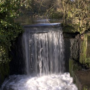
A mill on this site was recorded in the Domesday Book (1086). It gets its name from the ownership passing to the canons of Missenden Abbey in the 13th century. Last worked in 1937 and demolished in 1960.
Turn right just after the waterfall and follow the Heritage Trail and riverside walk back towards Chesham
Chesham Moor
Chesham Moor was originally swampland and manorial waste. In Victorian times it became a rubbish tip but is now a popular recreational area and is designated as common land. Take the small concrete footbridge at the end, go over Bois Moor Road and walk past the tennis courts and swimming pool.
Chesham Moor sports centre
Bathing in the stream on the Moor was an old Chesham custom, but then local residents complained about ‘the bathing nuisance’. In 1912 the first swimming pool was erected and in 1933 it had a facelift. In 1964 the whole building was reconstructed, and in later years a gym and tennis courts were added. Another major reconstruction project followed in 2024-2025. The pool is fed by spring water.
Continue ahead through the parking area and under the railway bridge.
Lords Mill Pond
The River Chess used to flow along what is now Moor Road but was diverted to feed Lords Mill.
Railway Bridge
The railway line to Chesham was built as part of Edward Watkin’s grand plan to have a direct route between London and Manchester. However it got no further than Chesham Moor until the town paid to extend it into the town.
At the Junction with Amersham Road, cross over to the brick wall of Friedrichsdorf Corner.
Friedrichsdorf Corner
Named after one of Chesham’s twin towns but is also the site of the old Amy Mill. Possibly one of the four Chesham mills mentioned in Domesday Book. Owned in 19th century by the Rose family, who, in 1845, opened a new steam mill (Canada Mill) across the road.
Turn right at the wall, after a few paces, left over a wooden bridge into Meades Water Gardens. Follow the riverside path through the Gardens to emerge into Germain Street.
Meades Water Gardens
Originally the location of the millstream for Amy Mill, of which only the sluice gate now remains. The site was converted for use as watercress beds, and later, ornamental gardens. In 2008 the river was restored as part of a project to regenerate the gardens.
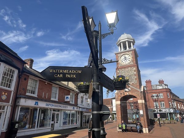
Turn right into Germain Street and take the pedestrian crossing over to the Market Square to finish the walk.
This series of history walks have been produced in conjunction with Chesham Museum and their walk leaders.
Original leaflet production sponsored by Chesham Town Council.
Original text and map leaflet © 2021 by Hawkes Design & Publishing Ltd
Amended for web with permission, and with some updates by Amanda Carroll for this website / Visit Chesham and villages project.
Edited for web by Amanda Carroll with permission.
Original printed leaflet published by Hawkes Design & Publishing.